Agro-Meteorological Forecast for the First 15-Day Period (1st-15th) of July, 2026
ISSUED AT: 07:56 PM
Date: Tuesday 30th of June 2026
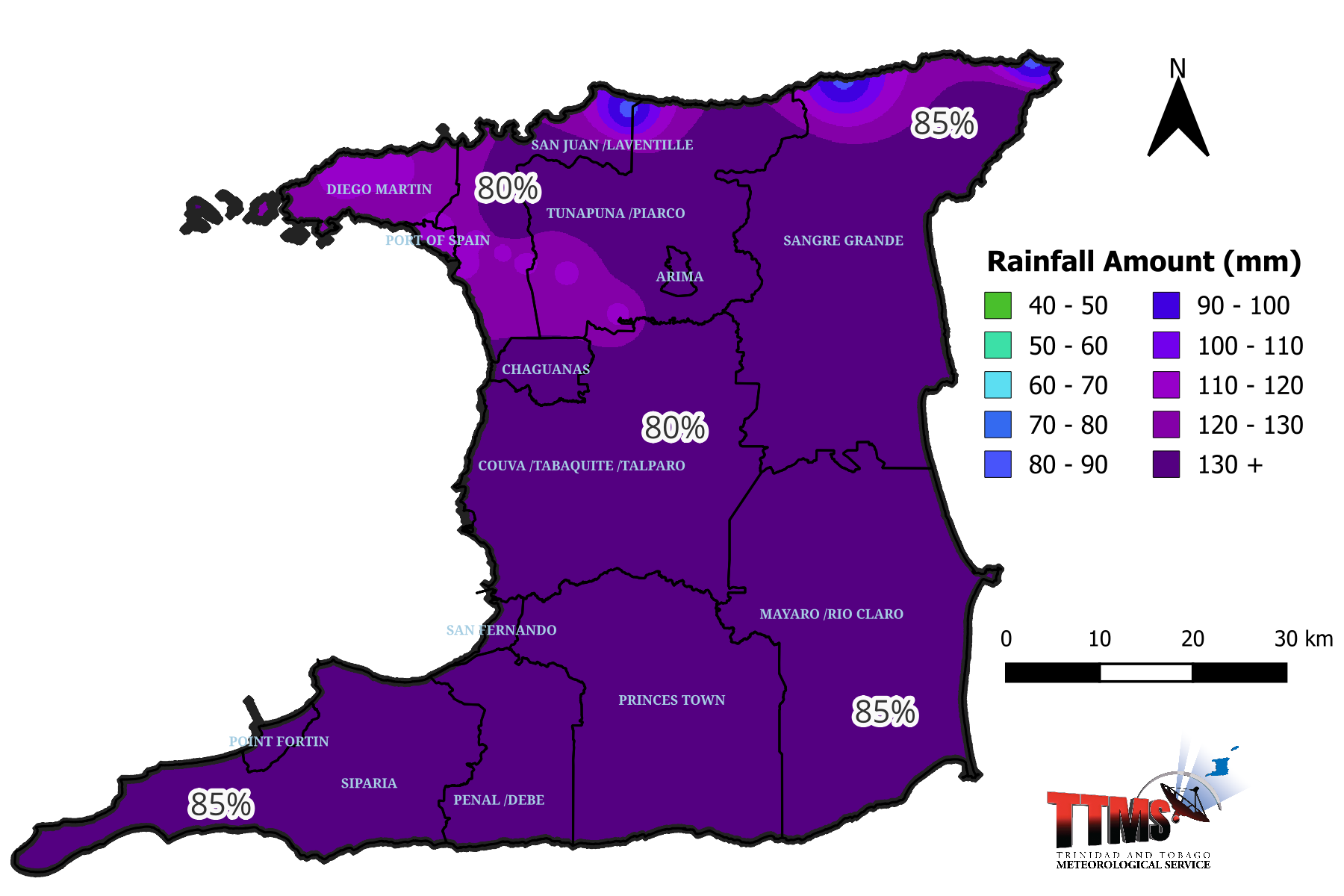
Figure 1.
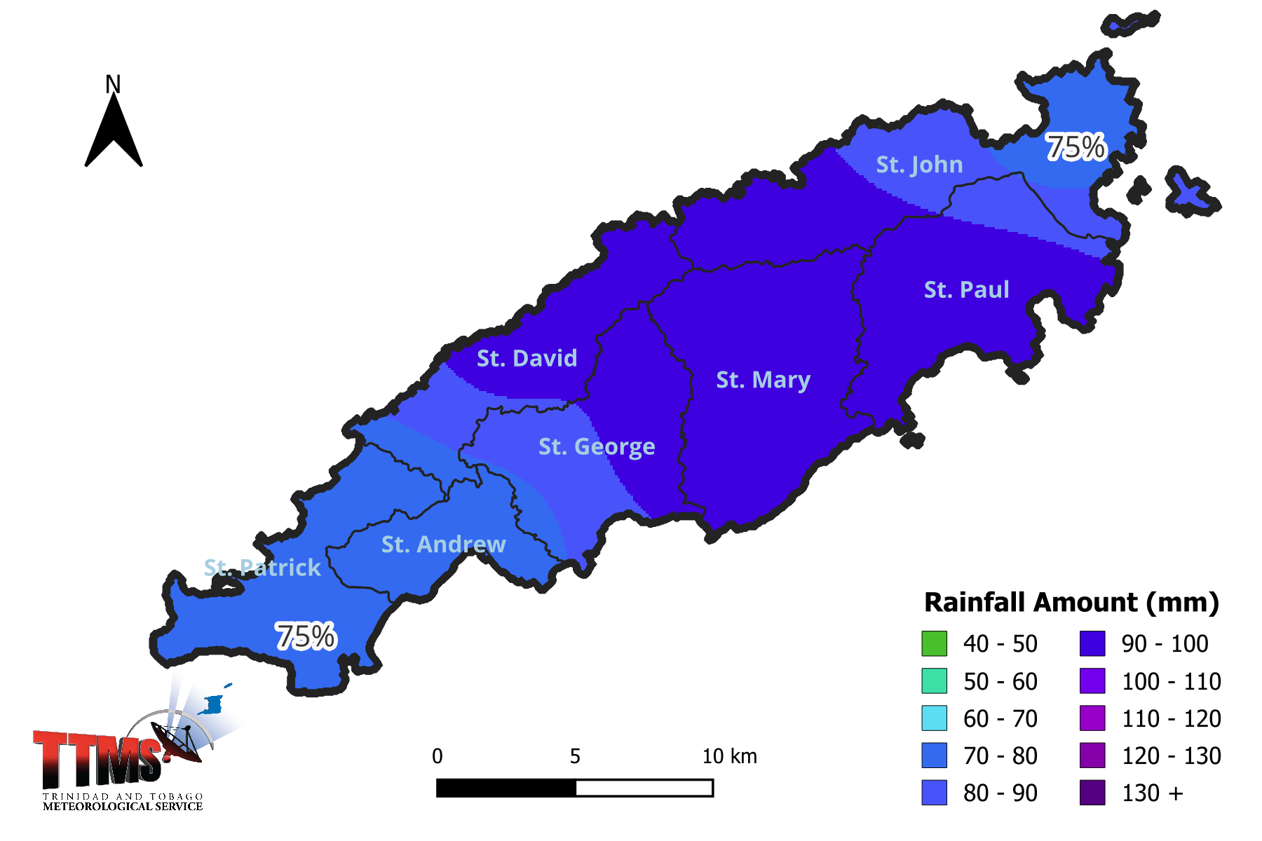
Figure 2.
Summary:
From 1st to 15th July 2026, expect near normal rainfall in Tobago and near to above-normal rainfall in Trinidad with wet days expected 2nd – 4th and 6th – 13th July 2026. Generally warm, especially at night, with a low to moderate risk of heat-related hazards.
Agro-Meteorological Forecast for the First 15-Day Period (1st-15th) of July, 2026
ISSUED AT: 07:56 PM
Date: Tuesday 30th of June 2026
Definition Guide:
| Term | Amount of Rain | Type of day |
| Scanty Rainfall | Less than 1 mm | Relatively dry day |
| Moderate Rainfall | 1-10 mm | Relatively wet day |
| Heavy Rainfall | 10-50 mm | Wet day |
| Very Heavy Rainfall | Greater than 50 mm | Excessively wet day |
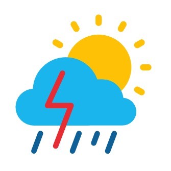
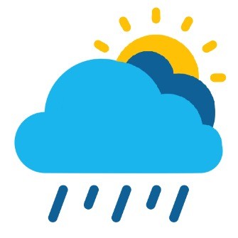
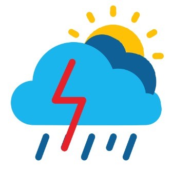
Date Weather Temperature Heat Index ‘Feels Like’ Day Moisture (Relative Humidity) Wind 1 60% chance of rainfall 2-6 mm of rainfall is possible Partly to mostly cloudy, hazy, brief showers Warm Max/Min Temperatures 32°C/25°C Feels like 35°C-35°C 54-70% East-northeast 11-30 km/h Gust 50 km/h 2 40% chance of rainfall 2-12 mm of rainfall is possible Partly to mostly cloudy, hazy, scattered showers, isolated heavy with thunderstorm Warm Max/Min Temperatures 32°C/25°C Feels like 37°C-37°C 60-85% East-northeast 11-30 km/h Gust 50 km/h 3 60% chance of rainfall 3-15 mm of rainfall is possible Partly cloudy to cloudy, scattered showers, isolated heavy with thunderstorm Warm Max/Min Temperatures 32°C/25°C Feels like 37°C-40°C 70-85% East-northeast 11-30 km/h Gust 50 km/h 4 60% chance of rainfall 3-10 mm of rainfall is possible Partly cloudy to cloudy, showers, periods of rain, isolated heavy with thunderstorm Warm Max/Min Temperatures 32°C/25°C Feels like 38°C-39°C 65-85% East 11-30 km/h Gust 50 km/h 5 40% chance of rainfall 2-8 mm of rainfall is possible Partly to mostly cloudy, scattered showers Warm Max/Min Temperatures 32°C/25°C Feels like 35°C-36°C 57-75% East-southeast 11-30 km/h Gust 50 km/h 6 60% chance of rainfall 3-12 mm of rainfall is possible Partly to mostly cloudy, scattered showers Warm Max/Min Temperatures 32°C/25°C Feels like 37°C-39°C 65-90% East-southeast 11-30 km/h Gust 50 km/h 7 60% chance of rainfall 3-20 mm of rainfall is possible Partly cloudy to cloudy, showers, periods of rain, possibly heavy with thunderstorm Warm Max/Min Temperatures 32°C/25°C Feels like 37°C-40°C 70-90% East-northeast 11-30 km/h Gust 50 km/h 8 60% chance of rainfall 3-15 mm of rainfall is possible Partly cloudy to cloudy, showers, periods of rain, possibly heavy with thunderstorm Warm Max/Min Temperatures 32°C/25°C Feels like 38°C-40°C 70-90% East 11-30 km/h Gust 50 km/h 9 60% chance of rainfall 3-15 mm of rainfall is possible Partly cloudy to cloudy, showers, periods of rain, possibly heavy with thunderstorm Warm Max/Min Temperatures 32°C/25°C Feels like 37°C-40°C 70-90% East-southeast 11-30 km/h Gust 50 km/h 10 60% chance of rainfall 3-15 mm of rainfall is possible Partly cloudy to cloudy, showers, periods of rain, possibly heavy with thunderstorm Warm Max/Min Temperatures 32°C/25°C Feels like 35°C-40°C 70-90% East-southeast 11-30 km/h Gust 50 km/h 11 60% chance of rainfall 3-12 mm of rainfall is possible Partly cloudy to cloudy, showers, periods of rain, possibly heavy with thunderstorm Warm Max/Min Temperatures 32°C/25°C Feels like 37°C-40°C 70-90% East 11-30 km/h Gust 50 km/h 12 60% chance of rainfall 3-12 mm of rainfall is possible Partly cloudy to cloudy, showers, periods of rain, possibly heavy with thunderstorm Warm Max/Min Temperatures 32°C/25°C Feels like 37°C-40°C 70-90% East 11-30 km/h Gust 50 km/h 13 40% chance of rainfall 3-10 mm of rainfall is possible Partly to mostly cloudy, scattered showers, isolated thunderstorm Warm Max/Min Temperatures 32°C/25°C Feels like 37°C-39°C 65-85% East 11-30 km/h Gust 50 km/h 14 40% chance of rainfall 3-8 mm of rainfall is possible Partly to mostly cloudy, scattered showers, isolated thunderstorm Warm Max/Min Temperatures 32°C/25°C Feels like 37°C-39°C 65-85% East 11-30 km/h Gust 50 km/h 15 40% chance of rainfall 3-8 mm of rainfall is possible Partly to mostly cloudy, scattered showers, isolated thunderstorm Warm Max/Min Temperatures 32°C/25°C Feels like 37°C-39°C 65-85% East 11-30 km/h Gust 50 km/h